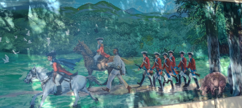
This 8-foot tall by 200-foot-long mural painted in 2016 by artist Parris Ashley, illustrates the history of the Cumberland, Maryland region beginning with the early Native Americans through George Washington and Fort Cumberland to the Underground Railroad, canal, bike path and the modern-day train presence. The mural is located on a wall below the Western Maryland Railroad tracks at Canal Place just off the GAP Bike Trail.
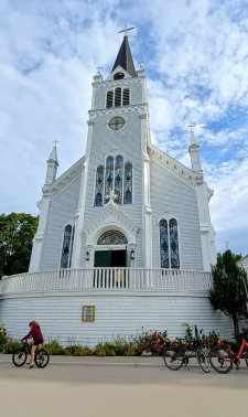
After bicycling the first of two eight-mile laps around the beautiful island, we attended 11am mass at this church where construction began in 1874 and finished in the mid-1880’s. A museum on the ground floor displays relics and the history of the parish and the area. Inside the church above the alter is a painting of St. Anne, the mother of Mary.
However, the catholic presence and the first catholic church structure on the island dates back to the late 1600’s. Just down the street is the Mission of St. Ignace Chapel, a birchbark structure that housed Father Dablon’s small chapel in 1670. Father Marquette moved the mission to the mainland in 1671 establishing the permanent mission there.
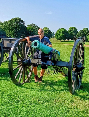
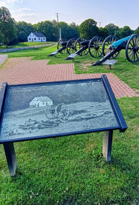
This major battle fought by 100,000 soldiers lasted 12 hours on September 17,1862 left 23,000 killed, wounded or missing. General Robert E. Lee and the Confederate Army forded the Potomac River and retreated to Virginia. We enjoyed the movie in the visitor center documenting the battle and then drove around the battlefield afterwards.
Expedition Team: Dave Miller, Rosie Miller, Nick, Jacque, Elizabeth & John Kelly
Date: June 13, 2026
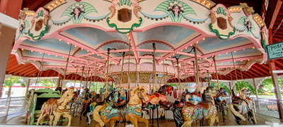
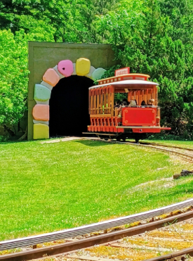
Truly an early roadside attraction that began in 1878 with hiking trails, bike paths, swings, shaded walks and picnic pavilions, it has expanded over the years with amusement rides, waterpark, Storybook Forest, miniature train rides, food booths, Fred Rogers Neighborhood Trolley and much more. Idlewild is the third oldest amusement park in the USA and the twelfth oldest in the world.
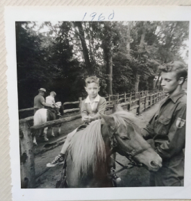
Early Park visitors came by the Ligonier Valley Railroad before cars took over and people arrived via the famous Lincoln Highway. This was my first visit in 61 years. Photos #1 & #2 show me riding rides in 1960. My Aunt Marie used to work there at a ticket booth when I was young and provided us with ride tickets.
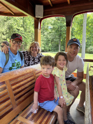
Our visit began with a private lunch with two characters, Daniel Tiger and Katerina Kittycat. We enjoyed pizza, salad, desserts and refreshments. The grandkids enjoyed riding rides, a train and visiting Daniel Toger’s Neighborhood where we rode through the exhibits on a trolley. Being a hot 85 degree day, the waterpark was wall to wall bodies, so we decided not to swim. But instead rode more rides.
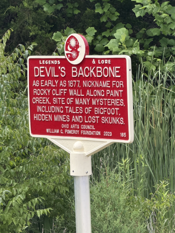
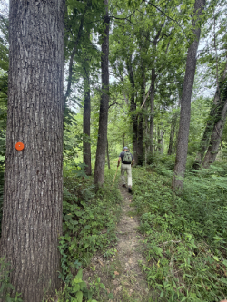
The Herbert & Patricia Wagers’ Memorial Park in Camden, Ohio—gets its eerie nickname from a dramatic, rocky limestone ridge that towers over the winding Paint Creek. The steep, narrow ridge has been known as “Devil’s Backbone” since the late 1870’s. Along the hiking trails are beautiful wildflowers, native pants, tree canopies and the flowing creek.
The Urban Legend associated with giving this preserve a mysterious, haunted reputation is threefold.
First, you have the missing skunk mystery just as the park historical marker states. In the early 1900’s, local residents had a get rich quick scheme to raise skunks beside the creek to sell their pelts only to return in the spring to find that almost all their skunks had mysteriously disappeared. Did they breed on their own in the preserve and become giant size?
Also, two mysterious, unsolved murders occurred on the land. In 1887, Herbert Howard was found murdered at his backbone farm. That murder remains unsolved to this day. Then there was the murder of Franklin Bourne on the same farm in 1912. A fellow farmhand was convicted of the murder but maintained his innocence until the day he died.
Thirdly, a history of Bigfoot sightings has been reported at the park. One example, back in 1977, two teenage boys saw a huge brown figure walking in the area.
Add to these two incidents, you may be hiking on park land where bodies of Native Americans were buried. Chief Little Turtle of the Miami Tribe warned settlers not to disturb the land as it was a sacred burial ground for the Miami Tribe. Is the land cursed?
For several springs, locals reported seeing two mysterious dark-haired men roaming Backbone’s hillside, but no one could ever get close enough to talk to the men. Many locals believe that the mysterious individuals are “ghost scouts” to administer the Chiefs curse.
In summary, there are many urban legends associated with this nature preserve. One thing is for sure, down along Paint Creek you can turn over rocks and find many fossils on the limestone ravine.
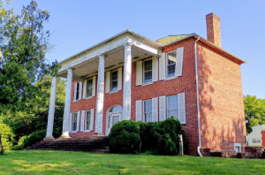
This historic plantation house once housed the headquarters of the C & O Canal National Historic Park and provided a look at plantation life along the Potomac River.
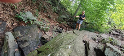
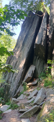
Good urban legends attract me, and this is a good one. This .3-mile hike near Mt. Davis, the highest point in Pennsylvania, kept me alert for black bears and wild turkeys. It culminated at a bunch of large rocks with dangerous crevices and a snaky path below winding through them. This isolated, strange area gave me the creeps. Two bizarre mysteries are associated with this area.
Henry Baughman had two sons and an extremely bad temper. One day in the 1850’s while looking for lost cows, Henry got mad at his son August and clubbed him with a stick. Thinking he was dead, Henry hid the body in the rocks with the intention of returning later and burying him. Returning later, the body had disappeared. Baughman was tried and convicted of second-degree murder based on his other son’s testimony. August’s body was never found.
A second urban legend is that in 1830, ten-year-old Lydia Shultz was sent to look for lost cows. She never came home. Search parties failed to find her. Months later she was discovered and had turned so wild that she hid from searchers. She had survived by eating wild plants and berries. She returned to civilization and allegedly lived to the age of 25.
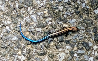
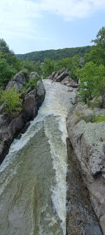
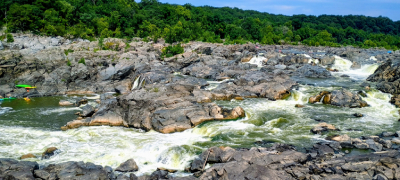
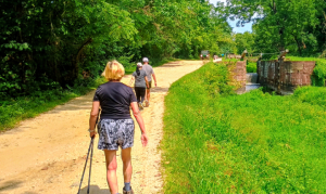
Beginning at the Great Falls Tavern Visitor Center, we hiked the towpath across Olmstead Island to view the Great Falls Overlook. Along the path, we saw a beautiful, blue salamander passed by wildflowers and native trees & bushes. This area was a protected fragile, bedrock terrace forest ecosystem. The Potomac River drops 60 feet at Great Falls. Raging through the gorge is a series of rapids dropping an additional 85 feet to Washington DC ten miles away. We watched the brave kayakers on the river.
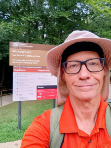
Skipping the challenging, strenuous Billy Goat Trail A, a couple miles down the towpath we hiked most of Billy Goat Trail C. We passed large rock outcroppings where people were rappelling and hiked through mostly thick woods.
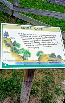
Located a half mile north of Fort Mackinac, near skull cave (a burial site for American Indians), this is one of only four cemeteries in the United States permanently permitted to fly the American flag at half-staff. This honor is maintained 24/7 to remember the unknown soldiers buried here.
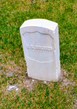
The cemetery contains over 140 graves and was built in the early 1800s to house both British and American soldiers who were killed in the War of 1812. After this, civilians and veterans of the American Civil War were also buried here. Many soldiers have been buried here, not many are named
Visitors have reported seeing ghostly apparitions among the gravestones and hearing the faint sound of weeping, believed to be the spirits of those who met tragic ends during the island’s tumultuous history. One such story tells of the ghost of a weeping mother, Mary Ella Cowles (Photo #5). She is seen over the 19th century graves of her two young children Josiah and Isabel. Thirteen other children died at the fort over the years and were all buried at the Fort Mackinac Post Cemetery, and if the haunting is real, there could be plenty of mothers coming to mourn for their little ones for all eternity.
We rested for a while at the cemetery as we had cycled about 14 miles so far around the island. We drank some water, ate a snack, then walked and took many photos in the cemetery. The cemetery was peaceful and serene, but very isolated and creepy at the same time. We heard no woman mourning but at nighttime, this area would definitely be dark and scary.
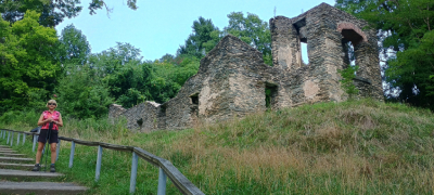
Four miles of the AT are in the state of West Virginia. We rode a van from the National Historic Park Visitor Center to downtown Harpers Ferry, a small historic town of 300 people. We hopped on the AT Trail just outside town, hiked the lower section of town past historic St. Peters Roman Catholic Church and up a steep hill and steps past the ruins of an old church. A half mile later we came to Jefferson Rock, several large masses of shale rock named after President Thomas Jefferson who stood there in October 1783. The rock gives a beautiful view of the Shenandoah River. The trail then took us up and down a ridgeline overlooking the river. We had lots of shade from overhead trees, but the heat and humidity were stifling as we gained altitude. Later, we doubled back and visited the AT Conservancy Center just off the path. On an overlook on top of the hill, we had beautiful views of downtown and the confluence of the Potomac and Shenandoah rivers. We stopped and had a delicious lunch at The Rabbit Hole. Afterwards we hopped back on the AT at the lower part of Harpers Ferry, visited the John Brown Museum, hiked across a pedestrian bridge across the Potomac River where the trail ended due to construction. Overall, we hiked about 3 miles on the AT Trail.