This fun 2.1-mile trail descended the ridge before crossing a creek and circling another ridge in a slow ascent. Although this trail was a thick pine forest when starting out, the trail itself had more leaves (Maple, Oak and Pine) on it than pine needles as we hiked along. Afterwards, we grabbed lunch at Blue Ridge and both of us enjoyed fresh trout and okra.
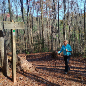
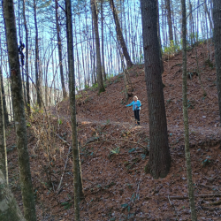
Via the Flat Creek Connector Trail, we hiked over half of the 5.1-mile Loop Trail which took us around a ridge and then a difficult ascent up. As I watched a nearby deer I turned back onto the trail and let out a yell as I almost swallowed this big spider (Photo #1). He had strung a web about head high across the trail. Luckily, I saw him that last second.
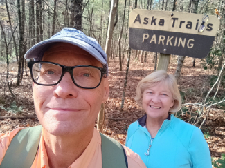
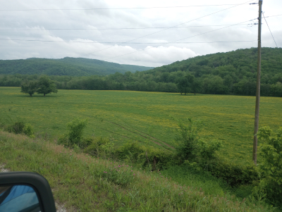
Back at the trailhead in the Deep Gap area, we crossed the road and began this 3.7 trail began north of Aska Road, which climbed towards the summit of Green Mountain. Lots of pine, laurel and rhododendron trees which occasionally opened up to give us a view of the ridges in the distance. We didn’t complete the entire trail as the sun dipped below the ridge and darkness came fast.
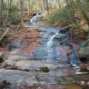
The two-mile trail ascended through a forest of laurel, rhododendron and pine and occasionally along a creek bank. The trail ended at a beautiful double waterfall. Across the stream there were a half dozen glamping yurt cabins for rent. A small segment of the trail was the Benton MacKaye Trail (BMT), a 400-mile trail through the Appalachian Mountains.
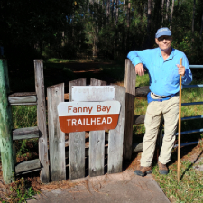
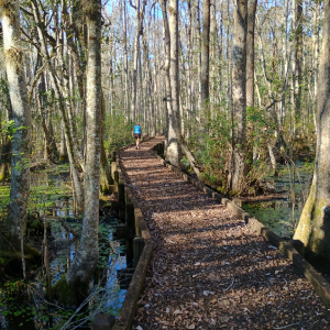
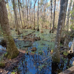
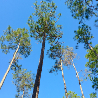
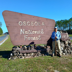
What a great idea, a hiking trail at an interstate rest area to give truckers and tourists a chance to stretch their legs. In northern Florida on westbound I-10 just behind the restrooms, the trailhead led us into a thick pine forest at the edge of Osceola National Forest. The final ¼ mile of the 1.5-mile trail was a boardwalk and the scenery changed to towering cypress trees and swampland. Below us in the watery flatwoods swamp we could hear gators splashing, frogs croaking, the constant buzzing of dragonflies and the pecking of woodpeckers.
This 200,000-acre forest in northeast Florida is made up of pine flatwood and cypress hardwood swamps. We hiked a section that was mostly pine trees with a very tall canopy. We passed a tall fire tower and then the trail eventually merged with the Florida National Scenic Trail, a 1,500-mile trail running throughout the state.
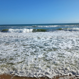
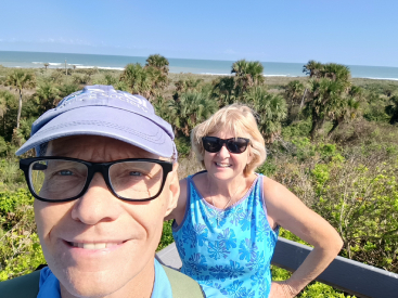
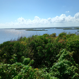
At this north park entrance the road parallel to Apollo Beach and the Atlantic Ocean ended after six miles in. Surprisingly, the last part of the beach was clothing optional. The beach was very pristine and not crowded at all. To the west was Mosquito Lagoon, home to manatees, birds and kayaking. We hiked three trails and saw turtles, an eagle, egrets and blue herons. Afterwards, we enjoyed lunch at Breakers Oceanfront restaurant a mahi mahi sandwiches.
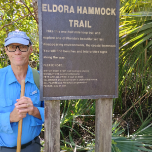
We hiked a one-mile-thick hammock trail of scrub palm, palm trees, oak and Spanish moss, thick hammock, and mango trees. I picked up some unusual yellow cherry sized seeds from one tree. It was very humid and 82 degrees. The trail ended at the Mosquito Lagoon where every morning many manatees are seen.
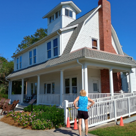
Native Americans and a few woodsmen lived off the land in this area prior to the settlement of Eldora in 1876. By 1900, the population reached 200 people. Settlers tried citrus farming & had a few successful years. But since the land sat at the edge of two temperature zones here, in the 1890’s two years of killing frost wiped out most of the citrus causing residents to leave and find work elsewhere. We visited the Eldora House built in 1912, which seemed to be the only structure left of the once small settlement. Inside the house were historical photos and displays from the past.
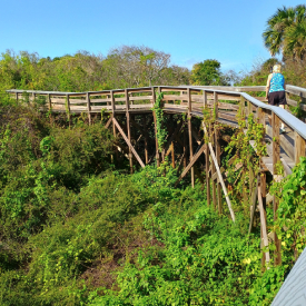
This short .7-mile archaeological trail was a long boardwalk built through and above a thick jungle-like overgrowth. On one observation deck we could see mosquito lagoon on the west, the Atlantic Ocean on the right with Cape Kennedy Space Center to the south. Just off the trail we saw two large turtles. Part of the 35-foot-high mound area is 1.5 million bushels of oyster shells piled up more than a thousand years ago by the Timucua indigenous people. A great location to see sunrises and sunsets.
A mile down the road we hiked the .9-mile Castle Windy Trail that connects the Atlantic Ocean and Apollo Beach to the Mosquito Lagoon. The scenery was very similar to the other trails in this park. We were surrounded by a thick hammock of scrub palm, bushes and oak trees.
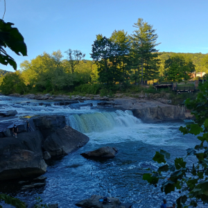
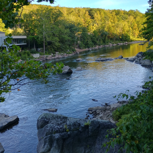
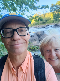
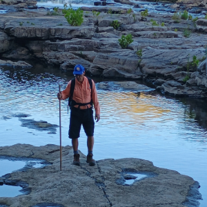
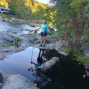
This 100-acre peninsula was a unique habitat that contained many rare and interesting plants. The Youghiogheny River wraps around the peninsula on three sides. Overall, we hiked about 2.3 miles first heading south on the Oakwood Trail, then to the short Butternut Trail and then north on the Ferncliff Trail. The trail took us through an old growth forest of towering hemlocks, white pines and giant oak trees. Along the river’s edge we passed the Ohiopyle Falls with many exposed rocks since the river was very low due to the summers semi-drought. We were careful when walking around eddies and waterholes in the rocks as one slip and we would wind up being swept away toward the dangerous falls.
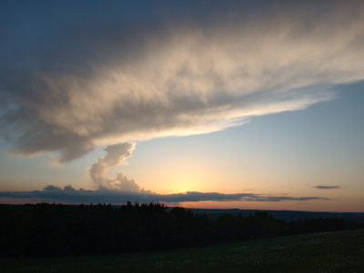
As we traveled to Ponca and the Buffalo National Scenic River we passed through this lush forest. This national forest has 1.2 million acres of hardwood and pine forests, scenic drives and clear mountain streams. It is one of America’s most scenic and beautiful areas. We drove for a while on the National Scenic Byway. At nighttime, we witnessed several beautiful sunsets.