After viewing the volcano from the lobby of the Volcano House, it was time to get back outside and hit the trail. This 1.3-mile trail spurred off of the Crater Rim Trail and took us lower and down to the crater edge giving us great views of the steaming Kilauea Crater. The trail eventually linked up with the Byron Ledge Trail.
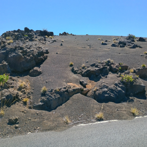
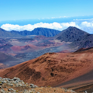
This short .8-mile trail gave us what rangers describe as a “moonscape” appearance thanks to the rocks and sand. The trail eventually took us past ancient rock walls and a crater rim viewpoint at 9,740 feet.
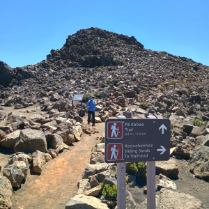
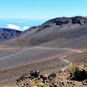
Farther up the mountain at 8,840 feet, we hiked this short .6-mile trail. Nene bird crossing signs were everywhere although I did not see any of these Hawaiian goose looking birds (Photo#3) driving up to the summit. The trail was a combination of rocks and dirt ending with a higher view of the crater. This rocky landscape is home to rare endemic, endangered insects and plants. We passed the ruins of a ranch wall (Photo#4) from long ago when several ranches existed at this extreme height. Trail signs warned us that the trade winds and high-altitude combination could change weather extremely fast dropping temperatures 30 to 40 degrees very fast.
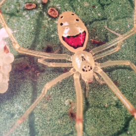
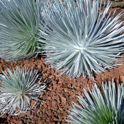
Our first hike at the national park. The trail began at 7,990 feet. as we were higher than the cumulus clouds. The trail was rocky 2.3 miles out and back trail with a 400-foot elevation change. We ended up at a viewpoint of the crater. Two couples from Canada took our photos on the rim. In the distance I could see the extension of this trail switchback down the crater wall and cross the crater for another six miles. One great find: as I was looking through the silversword plants and spider webs just off the trail, I spotted a happy face spider (Photo#4).
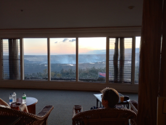
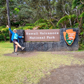
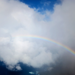
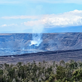
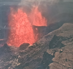
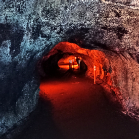
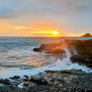
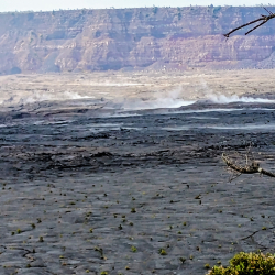
Located on the Big Island of Hawaii, this national park was established in 1916 and in the center of it are Mauna Loa and Kilauea active volcanoes. We hiked seven different trails and one lava tube. The terrain differed from the summit area at 4,000 feet down to the ocean. The trails by Kilauea rim were rocky with steam vents and some green growth. As we dropped in elevation you had flowers and plants growing through hardened black lava. Other areas were like a tropical rainforest with a wide variety of flora and fauna. Two nights we hiked over to the volcano rim and could see hot lava and its red fire burning. It erupted on our third day sending lava 400 to 500 feet into the air. And, of course, rainbows everywhere.
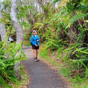
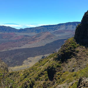
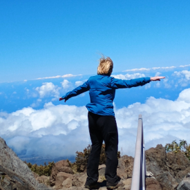
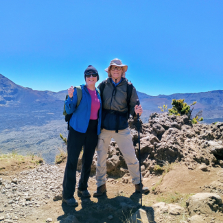
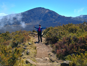
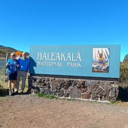
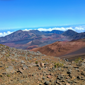
I finally made it to my 50th and final state. We received Hawaiian leis upon landing in Kona Airpark. Thank you, Jacque, for arranging this. This national park is located on the island of Maui and is home to the dormant Haleakala volcano and endangered Hawaiian geese called the Nene. The national park is divided into two districts. We hiked six rugged trails in the Summit District which climbs up to over 10,000 feet passing cinder cones and lava trails. The Summit District is home to several species that are endemic and found nowhere else in the world. The summit is sacred to Native Hawaiians. The 37 mile drive up from sea level to the summit is one of the greatest elevation gains in the shortest distance in the world.
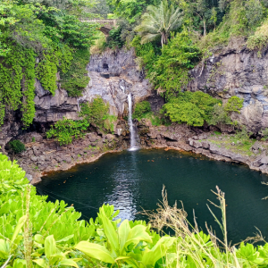
The Kipahulu District, on the lower southeast side of the mountain, was accessible only by driving the famous road to Hana Road. The 52-mile road had 59 bridges and 620 curves. This area had dozens of waterfalls, bamboo forests, clear pools of water and lush tropical rainforests. We hiked five trails in this area and one lava tube.
Rosie rested at the trailhead (later we decided that she had a little bit of high-altitude sickness) so I hiked 1.1 mile on this soft sand trail before turning around. The trail wound between, and around large rocks then dropped 100 feet and headed across the south side of the crater floor. The view of the crater was beautiful. I could look across in the distance to the far west side of the crater that we just hiked an hour before. Due to the elevation and soft sand, it took a lot longer to hike uphill out of the crater, but it was worth it.
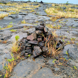
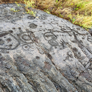
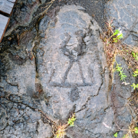
Rosie’s knee was hurting so she stayed in the car. I hiked this 1.6 mile out and back trail which was mostly hard black volcanic lava with occasional patches of black sand. It was rough on the knees and legs. A half mile onto the trail a very strong wind began blowing in my face along with blinding rain. Everywhere I looked was black lava rock. It was easy to get lost. I thought that perhaps the Hawaiian Gods were telling me to turn back. I said no way. This was a challenging and exciting adventure. Fortunately for me, up ahead were many ahu’s (stone cairns, which were stacks of black rock) marking the way. I finally came to a rectangular wooden boardwalk and the rain and winds stopped. As I walked around the boardwalk, on each side of me were thousands of very clear petroglyphs carved into the lava flow made by people between 1200 and 1450 AD. How the people lived in this harsh land was incredible. The design of each glyph (called piko puka) is as unique as the individual who created it. Some are carved deep, some shallow, others are more extravagant with many holes and circles providing a glimpse into their life experiences and their struggles. I eventually hiked back over the lava trail and as I crested a hill, I could see my lovely bride standing by the car worried and watching for my safe return.
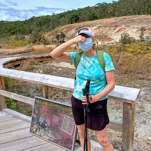
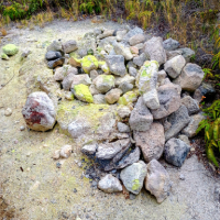
After hiking the Crater Rim Trail at 3,980 feet for several miles, we connected with the one-mile Sulphur Banks Trail just north of the Kilauea Caldera. After passing many steam vents we entered an area of hot, colored rocks and boiling sulfur pits which reminded us of the Yellowstone Park boiling mud pots and sulfur pits. The hydrogen sulfide gas smelled like sulfur and rotten eggs. Rosie said that it also smelled like my dirty, sweaty hiking socks. I took that as a compliment. A half mile down the trail it abruptly changed back to jungle and greenery again.
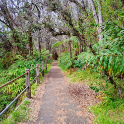
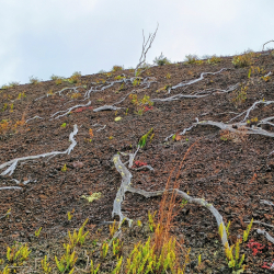
At Hawaii Volcanoes National Park, we hiked Devastation Trail on the east rim of the Kilauea Volcano Crater. So named, because of the lava destruction from the 1974 eruption. We had to be careful due to sinkholes, small craters, steam vents and earth cracks. Still, you could see in the sinkholes and volcanic rock, signs of life growing again (Photos #2, #3, #4) – green plants and beautiful wildflowers. After 1.6 miles and a 125-foot descent, we connected with the Bryon Ledge Trail for a mile or so and the devastation became a thriving jungle forest (Photo#5, #6) . Crossing the trail was a Hawaiian pheasant. On the cliff edge we could see the large crater and the smouldering Kilauea Volcano which erupted two days later.