KLONDIKE EXPRESS 26 GLACIER CRUISE Whittier, Alaska

Expedition Team:  Dave Miller, Rosie Miller                                                                                    Expedition Date:    July 8, 2018

Arriving at Whittier via the Alaska Railroad, Rosie and I boarded the 26 Glacier Boat named the “Klondike Express” to go see…..26 glaciers.  The town of Whittier average 20 feet of snow per year while the nearby mountains averaged 100 feet of snow.  During the 140 mile cruise we had an indoor front seat & table in the bow and enjoyed hot smoked salmon stew.  The five hour cruise took us through Esther Passage of Prince William Sound to Harriman Fjord and College Fjord and back to Whittier.

Along the way we saw orca whales, sea otters and many eagles.  One photo I took, not shown here,  shows an orca jumping out of the water.  The orca or killer whale is actually the largest of a group of marine mammals known as dolphins.  Prince William Sound is the home for 6,000 eagles.

We really did go by 26 glaciers on this cruise.  At Surprise Glacier (Photo#5-#7) the boat pulled up very close and you could hear what sounded like thunder as the glacier ice cracked and calved.  Up close the glacier snow looked sparkling blue in color.  A monk from Nepal was on the boat dressed only in a light sheet.  He had to be cold.  We posed with a Merry Christmas sign with a glacier as the backdrop.

On the return trip from the glaciers before reaching harbor we stopped by a bird rookery across the bay from Whittier. Ten thousand kittiwake birds inhabit the rocky cliffs each summer laying eggs.

ALASKA RAILROAD Anchorage, Alaska

Expedition Team:  Dave Miller, Rosie Miler                                                                                      Expedition Date:  July 8, 2018

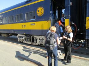
I surprised Rosie with a special trip.  We hopped on the Alaska Railroad at Anchorage for a 2.5 hour train ride southeast to Whittier.  Before we left Anchorage and it’s suburbs,  you could also see small airplanes in backyards.  The residents only needed a short grass or gravel runway or road to take off and fly anywhere around the state.  We were told one in 50 Alaskans fly airplanes to get around.  Most planes have interchangeable pontoons.

We passed beautiful landscape as the railroad ran parallel to the coast highway past Beluga Point.  You could see the tide was out creating dangerous mud flats.  One cloud that looked like an old airship or dirigible floated by.  The train passed many glaciers along the route.

Along the railway was the former town of Portage, destroyed in the horrific Good Friday earthquake (9.2 on the Richter scale) in 1964.  Ruins of one house remained from the earthquake’s tsunami.  The area’s elevation dropped 12 feet.  The flooding killed all of the green trees and turned them white, due to the influx of saltwater.

At Maynard Mountain the train went through the 2.5 mile Anton Anderson Memorial railroad tunnel (the longest rail-highway tunnel in the USA) and emerged at Whittier.  Over 90% of Whittier residents (population 400) live in one large apartment tower.  Nearby, several abandoned large buildings used by the Army in World War II as an outpost looked like a haunted  ghost town.  We boarded a large ship the “Klondike Express” for a special voyage out into Prince William Sound to see 26 glaciers.

After embarking from the train, I posed by a totem pole outside of the train station.  Overall, that day we left Anchorage at 9:45am and returned that evening at 9:15pm. It was a great train ride and glacier cruise.

DENALI NATIONAL PARK – WILDLIFE Alaska

Expedition Team:  Dave Miller, Rosie Miller                                                                                    Expedition Date:   July 5, 2018

 There are six major wild animals in Denali – bears, dall sheep, caribou, moose, wolves, red fox.  We saw all but wolves and red fox.  On the return three hour shuttle trip after morning hiking the skies cleared and we saw lots of wildlife and beautiful scenery.  We saw most of the wildlife between Mile 60, the steep, curvy Polychrome Pass at Mile 46 and at Mile 35 on the park road.

We saw many moose but one moose came up very close to use (Photo#1 & #2).  Between 300 and 350 grizzly bears live in the park.  They feed on berries and salmon. We saw several foraging in the distance (Photo #3) plus moose on the run  (Photo#4).


DENALI NATIONAL PARK – DINOSAUR TRACKS Alaska

Expedition Team:  Dave Miller, Rosie Miller                                                                                    Expedition Date:   July 5, 2018

Alaska weather can change fast. What started as a sunny day at mile 1 of the park road turned cloudy, cold with a slight rain 66 miles later at the end of park road.  After I hiked the Gorge Creek Trail we hopped on the park bus for the ride from Mile 66 to the Totlat Visitor Center and restrooms at mile 53.

At the visitor center we had great photos of the Totlat River, valley and distant mountains.  We walked a short trail and saw a replica cast of a cretaceous theropod footprint and a hadrosaur as these real dinosaur footprints were found in 2005 a short distance away from the trail.  The real cast footprint is in Photo#1.  My foot is next to the replica cast (Photo#2) and isn’t even a fifth of the size of the dinosaur.

On benches outside of the visitor center were several moose antlers that we held and tried on.  They were large and very heavy.

DENALI NATIONAL PARK – HIKING DENALI GORGE CREEK TRAIL Alaska

Expedition Team:  Dave Miller, Rosie Miller                                                                                      Expedition Date:  July 5, 2018

After hiking all day yesterday we had late dinner at Panorama Pizza Pub and played corn toss with the rest of the G Adventures group.  We were tired and slept good.  We got up early and drove the 1.5 miles to the park entrance.   This was the only cold, drizzly, foggy day of the trip where Mt. Denali was hidden in the fog & clouds.  Denali National Park is 6 million acres & is larger than the state of Massachusetts.

The park bus system is designed to cut down on traffic and litter.  At the visitor center we paid to take a Denali Park bus into the interior of the park.  You could get off anywhere and hike and then meet back at the dirt road and get back on any bus.  We first stopped at the 53 mile visitor center for a quick restroom break.  We then road the bus to the end of the park road to the Eielson Visitor Center at mile 66, a four hour bus ride each way.

We hiked the Denali Gorge Creek Trail.  The 2.25 mile moderate trail takes you down to a fast flowing creek and then back up 1,095 feet to the visitor center.  In the misty rain and fog you could not see far ahead on the trail.  We kept our bear spray handy in case a bear suddenly appeared out of the fog.  Rosie stayed at the visitor center and I was one of only four of our group of 13 that hiked this trail.  Jules from England led (Photo#4) and I was right behind her.  We finally reached the creek with a cairn (Photo#6) indicating we made it.  The creek was fed by snow melt from the nearby Sunset and the Muldrow Glaciers.  The trail climb coming back was a workout.  Got a photo of some wildflowers and an arctic ground squirrel on the trail (Photo#8).

Inside the Eielson Visitor Center, many nature and geology displays educated us.  A chart showed that on today, July 5th, 125 climbers were on Mt. Denali.  To date in 2018, 989 climbers tried to climb to the summit with 46% or 459 climbers were successful.

DENALI NATIONAL PARK – HIKING MT. HEALY TRAIL Alaska

Expedition Team:  Dave Miller, Rosie Miller                                                                                    Expedition Date:  July 4, 2018

Happy Independence Day! After lunch we re-entered the national park.  It was time to tackle the 4.3 mile Mt. Healy Overlook Trail in the afternoon.  The strenuous rated trail climbed 1,800 feet in elevation with many switchbacks.  The trail traverses through taiga forest into high alpine tundra. About a mile into the hike you could see in the distance the bald dome which was our destination, the top of Mt. Healy (Photo#3).  

Rosie carried her bear spray as bears were reported along the trail.  Just being myself, I would occasionally toss a rock into the woods and Rosie would think a bear was nearby.   At the summit we saw beautiful views of the park and beyond.  The sequence of photos (Photo#4-#6) show the climb which got steeper and harder as we ascended.

This was one of our favorite hiking trails of the trip and most rewarding when we finally reached the summit (Photo#8).  Photo #9 is the view looking from the summit back down to our hiking trail far below. We rested a few minutes, ate some snacks and enjoyed the dramatic views of the Nenana River Valley (Photo#10) where we went white water rafting two days later. 

When we finally descended and where back at the starting point of the trail I went to refill my water bottle.  Both doors to the Visitor Center said “Use Other Door”.  I didn’t know which door to use so I just walked away.


DENALI NATIONAL PARK Alaska

Expedition Team:  Dave Miller, Rosie Miller                                                                                    Expedition Date:  July 4, 2018

We left the charming town of Talkeetna, a former mining and trapping outpost, and drove 124 miles to the Denali National Park entrance.  Today was the first of three days at Denali National Park.  The park is over 6 million acres, larger than the state of Massachusetts.  We were told we would only see Mt. Denali one out of five days due to clouds or rain.  Incredibly, we saw the 20,310 foot majestic mountain four out of five days and had 60 to 68 degree weather each day except one.

We hiked two small trails in the late morning then checked into the Denali Perch Resort for lunch before we tackled the 4.3 mile Mt. Healy Overlook Trail in the afternoon.   We had a small A-Frame cabin complete with a bed in the loft (Photo#3-#4).  That evening we ate at the resorts tree top level restaurant called “The Perch” that had a beautiful overlook.  Rosie had salmon and salad while I tried the reindeer stew and salmon.  How many poor reindeers did I eat on this trip?  Afterwards, outside on the porch I shared a biscuit with a hungry ground squirrel.

MT. DENALI & TALKEETNA Talkeetna, Alaska

Expedition Team:  Dave Miller, Rosie Miller                                                                                      Expedition Date:    July 3, 2018

Our G Adventures group drove 375 miles north from Seward  past beautiful mountain and glacial scenery (Photo#1) to the town of Talkeetna (population 800).  Before we hit town we pulled over and saw Mt. Denali in the distance for the first time (Photo#3).  Talkeetna is the last stopping point for mountain climbers wanting to climb Mt. Denali.   The five street town had restaurants, shops and a National Park Office.  Rosie & I hiked one mile on the flooded Talkeetna River Trail  (Photo#5) with Mt. Denali lurking in the distance.  We stayed the night at the Swiss-Alaska Inn.

At the edge of town I explored the Talkeetna Cemetery Photos#6-#8).  In lieu of regular headstones it had the most unique, creative memorials I have ever seen such as a house with a cat on the roof, a propeller for a former pilot & part of a backhoe for a heavy equipment operator.  There was also a memorial to climbers who died trying to scale Mt. Denali.

Every July at the Talkeetna Moose Dropping Festival they hold a contest where participants compete to see who can throw a moose poop nugget the farthest distance.

For dinner at the Denali Beer Pub and Brew Garden, I enjoyed for the first time reindeer meatloaf  (Photo#9) with mashed potatoes, gravy and an Alaskan agave gold beer.  For breakfast the next morning I ate a delicious Swiss concoction called roesti  (Photo#10) consisting of three pounds of eggs, potatoes & reindeer sausage mixed together.

CUYAHOGA VALLEY NATIONAL PARK Brecksville, Ohio

Expedition Team: Rosie Miller, Dave Miller
Expedition Date: May 2017

Cuyahoga Valley NP in northeast differs from other national parks in that it is located between two large cities (Akron & Cleveland) and includes a dense road network, a railroad, small towns public and private attractions.   One component is the Towpath Trail, a 20-mile bike path originally the tow path for the Ohio & Erie Canal. The canal was built from 1825 to 1832.  Parallel to the bike path is the canal and in some places the Cuyahoga River. Over 75% of the canal still holds water and seven locks still exist in good condition along with a few historical houses. The park has over 125 miles of trails. We hiked one of park trails and saw a nice waterfall.

In the summer a train will run from south of the park north towards Cleveland.  People biking can bike the 20 miles and then hop the train with the bicycle and ride back to their starting point.  In the southern part of the Towpath Trail is a beautiful wetlands area with turtles, birds and other scenery. In addition, three visitor centers and several historical houses are along the trail.

I am glad Ohio has a “national park” and it is a nice place to visit but it does not seem anywhere as majestic as the large national parks that are in the western United States. If I had my choice for a National Park in Ohio it would be Hocking Hills State Park, as it has great hiking trails and beautiful rock structures and waterfalls.