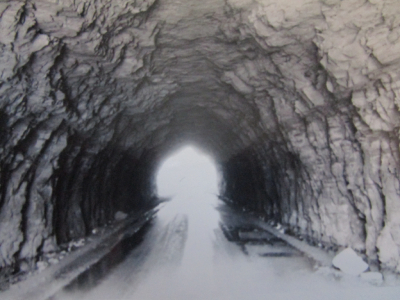
A few miles west of Morehead, Kentucky was a dangerous but fun hiking trail in the Cumberland Plateau in Daniel Boone National Forest. I drove to the trailhead via Clack Mountain Road which passes a waterfall and goes through a tight tunnel (Photo #3 & #4). The Lockegee Rock Trail is only a mile long and is an easy hike through woods and rock with only a 140 foot elevation climb. With all of the nooks and crannies in the rocks I kept an eye out for rattlesnakes. The final ascent is a steep 20 foot rock climb that has hand holds but was still scary. When reaching the rock summit at 1,362 feet you can sit safely near the edge and lookout across the tree laden countryside with Cave Run Lake in the distance. I took six photos moving the camera a little each time and once printed, taped them together creating a great majestic panoramic view of the entire area. Nearby Cave Run Lake is a man-made lake created by damming up the Licking River. The small, once thriving town of Yale is now submerged underwater. Sadly, poor visibility does not provide me the opportunity to scuba dive there.
I was at Portland for the 1990 Rotary International Convention. I traveled south down the Oregon coast (Photo#5), then east over to Crater Lake National Park. After driving around the national parks perimeter road and stopping by the Visitors Center, I then drove north to Mt. Hood, the second most climbed mountain in the world. I drove up 6,000 feet on the former old Oregon Trail to Timberline Lodge & Ski Area (Photo#1 ) located on the southern flank of the mountain just below Palmer Glacier. It was summer so most skiers and snow boarders wore short sleeve shirts. I hiked 1.5 miles (Photo#3 & #4) viewing the alpine terrain and beautiful vistas of the glacier caked summit which is 11,200 feet high. At one panoramic overlook I enjoyed a beautiful view of the Hood River Valley. On my hike I found no Sasquatch tracks. I then drove Route 26, a 80 mile loop through beautiful forests, valleys and fruit farms eventually arriving at the Columbia River. The river was the last leg of Lewis & Clarks famous expedition 185 years ago.
This endurance run was on my bucket list since I was in high school. Rosie ran the New York Marathon in 1985. I decided to train and run the 1986 marathon with Rosie. In 1986 we stayed in a hotel at midtown Manhattan and hopped on a bus at 5am at the New York Public Library to shuttle us to Staten Island where the race began. The race route winded through all five boroughs of New York. When the cannon boomed to start the 26 mile 385 yard race we were two of over 20,000 runners participating. We immediately ran across the Verrazzano-Narrows Bridge. As a tradition, men who couldn’t make it to the largest latrine that I have ever seen would pee off the side of the bridge.
We entered the Brooklyn and ran eleven miles of winding roads through many neighborhoods. At the halfway mark, mile 13 we crossed Pulaski Bridge into Queens. We reached Manhattan at mile 16 and ran north on First Street and into the Bronx for only one mile. Back in Manhattan we ran through Harlem then south towards Central Park. The last 5 miles was through Central Park. Over 2.5 million people lined the course cheering. Rosie was trying to beat the 3 hour fifty minute mark and qualify for the Boston Marathon. Rosie started the race far up in the pack (at the seven minute per mile pace). Just past the 13 mile marker Rosie was averaging a 3 hr. 40 minute marathon pace much faster than she had planned to go. At mile 14 she hit “the wall” and had to slow down her pace. She still almost broke four hours and finished (Photo#1) with a great time of 4 hours 6 minutes (10 minutes faster than the previous year). Rosie finished 1,100th out of over 11,000 women. I plodded along at my pace (Photo#2) and was quite satisfied finishing at 4 hours 24 minutes (Photo#3). I wore my Theta Chi Fraternity running jersey. Many spectators yelled go “Theta Chi” but those who did not recognize Greek letters yelled “Go OX”. After the race we ordered a super large NY style pizza, watched the movie “Little Trouble in Big China” starring Kurt Russel on TV and fell asleep. Dayton Daily News did a nice article about us running the marathon (Photo#5). We were very happy with our accomplishment completing one of the world’s most popular marathons.
Located in the Mojave Desert, this National Conservation Area located a few miles west of Las Vegas has almost 200,000 acres of geology featuring rock formations, sandstone cliffs, colorful red iron oxide or hematite rock and dinosaur tracks. I hiked Calico Hills, a trail running from Calico Basin to Calico Rocks. I saw a variety of cactus and a couple lizards along the trail. I left the trail and began climbing a moderate trail up into the rocks (Photos#1-#3). I heard native American music and chanting up ahead around the bend. I came upon a man who was playing music on a tape recorder, chanting and shaking an Indian gourd that rattles. He was facing the sun and was obviously performing some type of ceremony so out of respect I quietly passed by and headed up the rocky overlook. Overall, I hiked about four miles in this blazing heat . Always carry lots of water with you. Driving back we saw “Slow, Wild Ass” signs. Yes, I know I was near Las Vegas but that’s not what the signs meant. Just around the curve I hit the breaks as several wild asses or burros (Photo#4) were crossing the road. They are protected in this conservation area. Heading back I stopped at Old Nevada, a small gas station/casino and utilized a unique, “can’t miss” urinal (Photo#5).
Expedition Team: Dave Miller, Rosie Miller, Jacque Miller, Matt Miller, Holly Miller, Shane Miller, Debbie Orca Miller
Date: 1995, August 10, 2002, Sept. 2004
We were in Atlanta to attend my sisters graduate from Emory University School of Nursing. We camped out at Stone Mountain Park Campground and enjoyed hot dogs and smores cooked over the campfire (Photo#1). Matt videotaped a segment of his “Orca Files here. “The world’s largest mass of exposed granite is the centerpiece of the 3,200 acre wooded park. We took a ride on the riverboat (Photo#2) & had fun in the Great Barn that had lots of interactive children’s activities. At night we enjoyed the great laser light/music show shown on the side of the mountain (Photo#3) with Gen. Stonewall Jackson on horseback carved in the mountain. On Saturday afternoon we drove to the park railroad station/museum and the trailhead to hike up Stone Mountain. The trail is just one mile one way to the summit but you climb over 800 to the top. Everyone was pumped and confident at the beginning but it was a difficult hike for Shane who was 8 years old and for the Orca. We took a short break at the Halfway House which was a small shelter house and then ascended the rest of the trail. The top was very smooth rock and some of the kids were afraid of sliding off (Photo#4). You had an incredible view of the park as well as downtown Atlanta 20 miles away. You could take a skylift/cable car back down which we did one previous time but we chose to hike the one mile back down.
Expedition Team: Dave Miller, Rosie Miller, Debbie “The Orca” Miller, Jacque Miller, Matt Miller, Holly Miller, Shane Miller
Date: July 2002
Known as the “Niagra of the South”, Cumberland Falls State Resort Park featured a beautiful 125 foot wide curtain of water that drops 68 feet (Photo #2 & #3). The falls is one of only two places on the planet where you can see a moonbow on a consistent basis. During full moon, a moonbow can be seen in the falls. We hiked parallel to the Cumberland River on the Moonbow Trail that connected to moderate Eagle Falls Trail. This 4.5 mile hike took is into the forest to Eagle Falls (Photo#4) where Matt is standing in front of the 48 foot tall falls. We climbed over and under large rocks and ledges exploring crevices (Photo#5). I had walkie talkies with headsets so we took turns with one child being the trailblazer in front with one radio and another child in the rear with another radio.
I was very proud of my beautiful, fit wife as she completed the Bud Light Caesars Creek Triathlon in just 2 hours and 26 minutes. It was held at Caesars Creek State Park. Rosie swam the challenging .6 mile swim in open water at Caesars Creek Lake. She then jumped on her bike for a 22 mile trek through the countryside and finished with a 6 mile dash to the finish line.
Expedition Team: Dave Miller, Rosie Miller, Jacque Miller, Matt Miller, Holly Miller, Shane Miller
Date: 1987 & July 7, 2003
This State Park and wildlife reserve is in southwest South Dakota and had granite peaks and rolling plains. Named after Lt. Colonel George Armstrong Custer, the park located in the Black Hills is South Dakota’s largest and first state park. We drove Needles Highway (Photo#6) and the Wildlife loop and saw as many bison here as we did in Yellowstone NP. We saw several mountain goats resting a few feet off the main road and when we turned the curve we stopped suddenly as a herd of over 40 bison slowly walked across the road and past our van and camper. Matt would shout, “Hey Hairy, get out of the road”. We hiked the 2 mile Sunday Gulch Trail near Sylvan Lake. It meandered from the lake through forest, open prairie areas and granite rocks.
The Flying Pig Half Marathon was one challenging race. Daughter Jacque was supposed to run it with me but hurt her leg during training and could not run. Rosie ran as a bandit and ran the first three miles only. She and Jacque cheered me on at the finish line. The race began near Great American Baseball Stadium and the Coliseum. The route took us over Taylor Southgate Bridge into Kentucky past the Newport Aquarium then wound through the streets of Newport and Covington. Re re-entered Ohio via the Wade Bailey Bridge and ran on Johnny Bench Way and Pete Rose Way.
Mile 5 through 7 was quite the challenge as Gilbert Avenue slowly climbed 400 feet climb up and around Eden Park overlook with a great cliff view both east and west of the Ohio River. What goes up must come down so three miles later I was back at Gilbert Avenue for a 1 ¼ mile downhill dash. Thanks to gravity I practically sprinted all the way down only to realize I still had 2 miles to go. I just had enough gas left in the tank to make it to the finish line beside Great American Ballpark. My chip time was 2 hrs. 11 minutes. There were 7,361 overall participants.
The Wilds is a private 10,000 acre safari park and conservation area. Our van hit a deer ten miles from the Wilds and sustained damage to the grill and headlight. Once at the Wilds we tackled the 5 long zip lines. We zipped over ponds, pastures, woods, deer and Sichuan takins basking in the sun. After a short lunch break we took an open air safari tour and saw up close giraffes, takins, deer, rhino, oryx, horses and camels. The giraffe almost stuck his head inside our open air safari vehicle. Holly laughed and marveled at the speed of the ostriches.